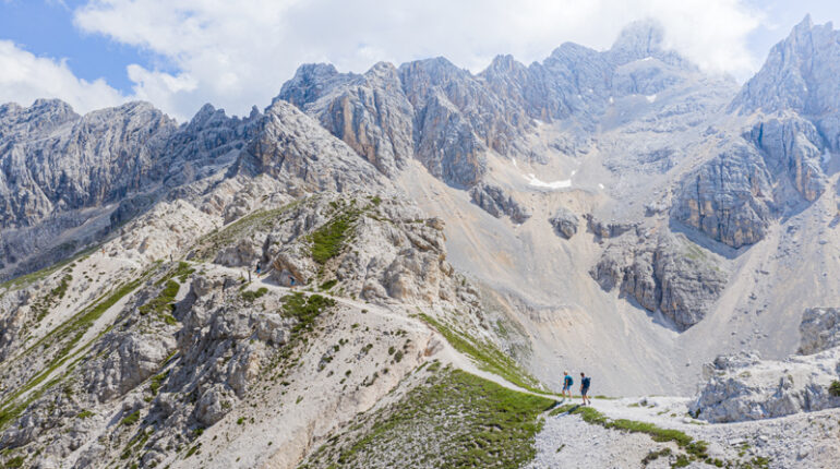
The Karnische Höhenweg, KHW 403 for short, is a unique experience for hikers, geologists and nature lovers. Again and again you pass smaller and larger lakes, whereby the Wolayersee with its crystal-clear water clearly stands out. On the last stage you can enjoy incomparable views of the UNESCO World Heritage. The more exposed part will be passed generously.
The easy hike runs along well-marked mountain and hiking trails. The tour is suitable for everyone with a good basic condition. Climbing skills are not necessary. The hiking tour is suitable for children aged 14 and
over.
Included and Not Included Services
Accommodation in inns and hotels 3*** category, 1 accomodation in a mountain guesthouse (Val Visdende)
Breakfast buffet or full breakfast
Videobriefing
Luggage transfer from hotel to hotel
Tickets for transfers according to the program., cable car tickets Nassfeld and Helm
Well planned route
Detailed documents (maps, route description, places to visit, important telephone numbers)
Navigation APP
Telephone service hotline for the entire tour
Arrival to the starting point of the tour
Departure at the end of the tour from Sillian
Drinks, tourist tax and all extras
Lunch, Dinner (if not booked)
Bus tickets
Day 4 chair lift Sappada (if you want to shorten the stage)
Not mentioned entries
Travel insurance
All not expressly mentioned under the item „Included services“
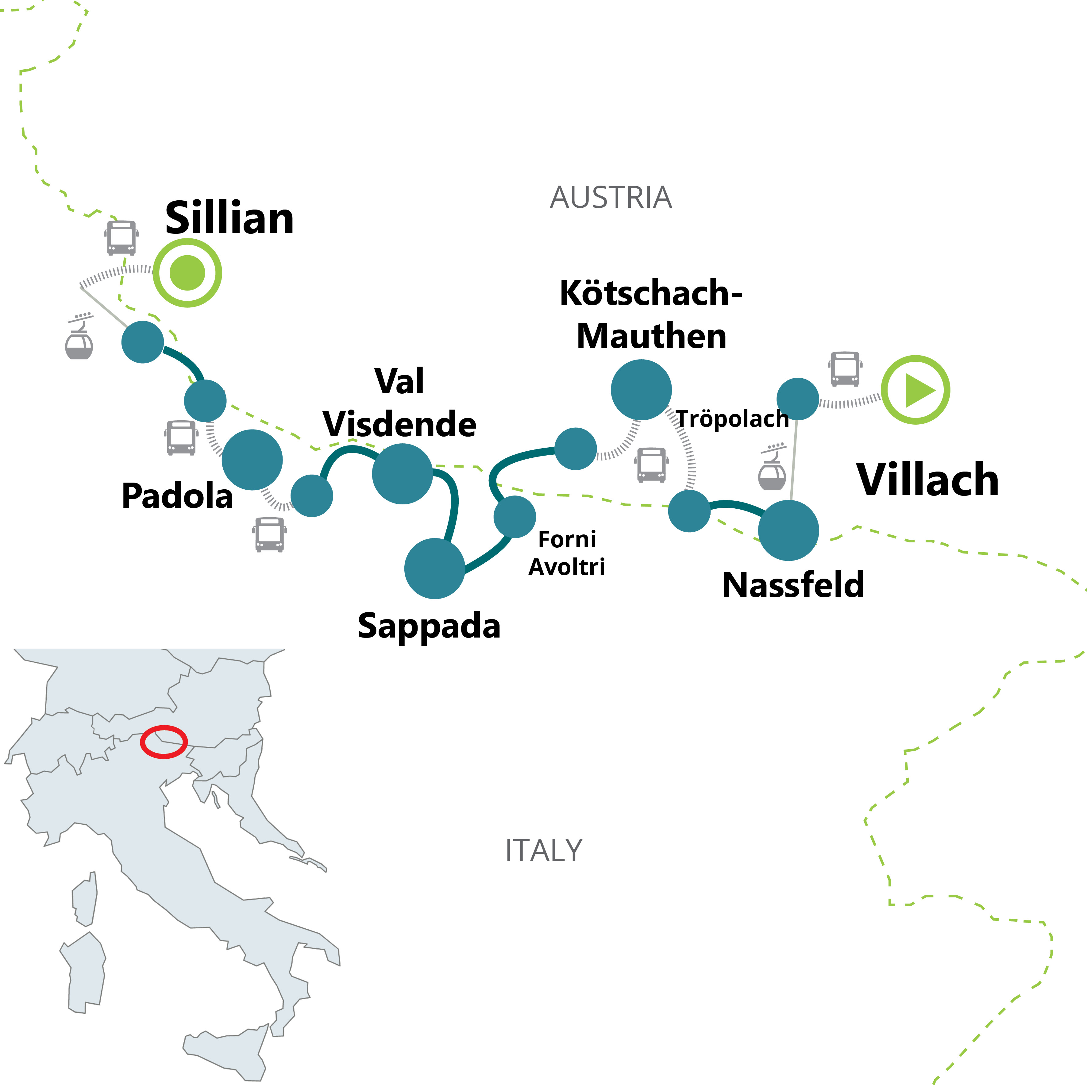
Day 1: Villach
Individual arrival at the hotel in Villach.
Day 2: Nassfeld - Straniger Alm - Kötschach Mauten
(ascent approx. 460 m, descent 860 m / approx. 4.5 hours)
In the morning you take the public transport from Villach to Tröpolach (incl.). From there you take the cable car to the starting point of the stage (incl.). Along the Carnic High Trail you will hike up to the Nassfeld Pass and past variours larger and smaller lakes. Fields of alpine roses, wet meadows with cottongrass and numerous orchid species, as well as many steams characterise the landscape. Enjoy the excellent cheese specialities for which this region is famous and which are produced in the many alpine cheese dairies. At the end of the stage, a transfer takes you from the Straniger Alm to Kötschach Mauthen.
Day 3: Kötschach Mauthen - Rifugio Marinelli or Lake Wolayer - Forni Avoltri
(ascent approx. 850 m, descent approx. 850 m / approx. 5.5 hours - variant: ascent approx. 1.075 m, descent approx. 775 m / approx. 5.5 hours)
Public transport will take you to the starting point at the Plöckenpass or Kreuztratte (ticket not included). There are two different variant you can choose from: the first variant takes you to the Rifugio Marinelli, with a view of the Monte Crostis and Monte Pezzacul and then to Collina. With the second variant, you climb via the Carinthian border trail to the Valentin Törl and then continue to the deep blue Wolayer See and Woyaler Pass and then descend to Collina. At the end of the stage a public bus will take you to Forni Avoltri.
Day 4: Forni Avoltri - Sappada
(ascent approx. 950 m, descent approx. 850 m / approx. 6,5 hours - variant: ascent approx. 750 m, descent approx. 450 m / approx. 5 hours)
Starting from Forni Avoltri, you walk through forests past Colle degli Scoiattoli and Monte Geu. The view over the valley down to the surrounding mountains is breathtaking. Continue hiking to the Rifugio Monte Siera, which invites you to a well-deserved stop for refreshments, and then to Sappada. In the easier variant, you hike past the Casera Tuglia below the Colle degli Scoiattoli to Cima Sappada and then to Sappada.
Day 5: Sappada - Val Visende
(ascent approx. 1.150 m or 750 m, descent approx. 1.190 m / approx. 6 hours - Variant: ascent approx. 820 m, descent approx. 720 m / approx. 5,5 - 6,5 hours)
It is possible to shorten the first 400 metres of the ascent with the chairlift from Sappada (ticket not included). You hike along the magnificent Laghi d`Olbe. The surroundings of the lakes belong to the most charming mountain areas of the Carnic Alps. From the Passo del Mulo you will enjoy the magnificent view of the mighty rock castles of Hochweißstein, Monte Chiadenis and M. Avanza. Via the Forcella del Franza you will hike through the beautiful high valley of Val Popera and then leisurely along forest paths to Val Visdende, the ending point of this stage. As an alternative, you can hike over the Sorgenti del Piave. This is the source of the Piave River.
Day 6: Val Visende - Val Digon - Padola
(ascent approx. 920 m, descent approx. 980 m / approx. 6 hours)
Hike through woods and flower meadows from Val Visdende slightly below the actual high trail to the Passo Palombino and then on to Sega Digon. This untouched valley in the Dolomites is a natural oasis, which has been spared from mass tourism. At the end of the stage you take the public bus to Padola (ticket not included).
Day 7: Padola - Helm - Sillian
(ascent approx. 890 m, descent approx. 470 m / approx. 5 - 5.5 hours)
In the morning, you will take the public bus from Padola to the Kreuzberg Pass (ticket not included). You will pass the Klammbachalm and the Sillianer Hütte. Without noticing it, you cross the border to Austria and hike back to Italy. With a view of the famous Sesto sundial, the Dolomite peaks towering high above Sexten peaks Neuner, Zehner (Sextner Rotwand), Elfer, Zwölfer and Einser, you hike along the Carnic ridge. Take the cable car from Helm to Vierschach (ticket incl.). There you will take the train to Sillian (ticket not incl.).
Day 8: Sillian
Individual departure from Villach or possibility to extend your stay.
By car: Villach is easy to reach via the A2, A10 or A11 motorways (depending on the place of origin).
By train: good travel options by train to Villach. Timetables at: www.deutschebahn.de, www.oebb.at, www.trenitalia.com.
By plane: Klagenfurt, Salzburg or Ljubljana airport. From all three places there are good train connections to Villach.
Inns and hotels 3*** category, 1 overnight in a mountain guesthouse (Val Visdende).
Attention: Tourist tax – if requested – has to be paid on the spot!
Depending on the start hotel, parking facilities are available (reservation not possible; payable upon arrival) or free unguarded public car park near the centre (reservation not possible).
Every Sunday transfer from Sillian to Villach at a price of € 79.00 per person (reservation and payment upon booking).
Alternative: good train connections from Sillian to Villach: timetable on www.oebb.at
We suggest travel insurance.
Light, comfortable clothing is advisable. In addition to the usual equipment (clothes, washing things) we recommend hiking or trekking trousers, gloves, hiking or trekking shoes (hard sole and high shaft protect feet), hiking sticks, rain jacket/protection/sunshield (cap, glasses), small rucksack for the day's provisions, water bottle, personal medication, small first-aid kit (plaster, elastic bandage, disinfection, ointment against strains).
Transfers to the starting points are organised directly by us using a shuttle bus or public transport. You can find more information in the travel documents.
The easy hike runs along well-marked mountain and hiking trails. The tour is suitable for everyone with a good basic condition. Climbing skills are not necessary.
Every Sunday we organise a return transfer by shuttle bus from Sillian back to Villach (reservation and payment required when booking).
Alternatively, there are good train connections. You can find the current timetables at www.oebb.at and www.trenitalia.com.
You might also be interested in

Quotation
Send RequestUnfortunately, this tour is currently unavailable. However, we welcome you to submit an individual request.
Tour information
- Duration 8 days
- Minimum age 14 years and older
- Difficulty Level Easy
- Distance 61.5 - 78.5 km


